
Canva vs MapMyMemories: Which Free Tool Is Better for Travel Route Maps?
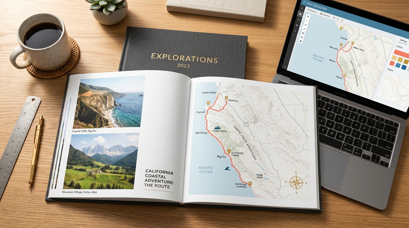
Many travelers open Canva first when they want to make a travel map for a photobook, a wall poster, or a trip presentation. After searching Canva's template library for ten minutes, a frustrating limitation becomes obvious: Canva has static country illustrations and decorative pins, but it does not have a real map engine that calculates roads, flight arcs, train tracks, or ferry routes between cities.
If you are comparing free map maker tools with Canva, the right choice depends on what you are trying to build. Canva is a general graphic design editor for page layouts and typography. MapMyMemories is a dedicated travel route map generator that plots real geographic coordinates, imports GPX and KML tracks, and exports 300 DPI and 600 DPI print files for free.
Canva vs MapMyMemories: Quick Comparison
Here is a direct comparison of what each tool can and cannot do when creating a printable travel map:
| Feature | Canva | MapMyMemories |
|---|---|---|
| Real road, flight & train routing | No (manual curved lines only) | Automatic routing by car, plane, train, ferry, bike, foot |
| GPX / KML / KMZ track import | No | GPX / KML / KMZ |
| Print export resolution | 96 DPI PNG/JPG (PDF Print 300 DPI) | Up to 600 DPI (JPG, PNG, PDF) |
| Cartographic map styles | Static vector clip-art shapes | 6+ detailed map themes (Vintage, Minimal, Dark, Terrain) |
| Photobook & multi-photo page collages | Full drag-and-drop graphic editor | Dedicated map poster & PDF brochure layouts |
| Animated route video export | Manual slide animations only | Automatic MP4 route animation along the path |
| Price for print-ready export | Free tier + Canva Pro ($15/month) | 100% Free (no watermark, 300/600 DPI included) |
How Canva Handles Travel Maps
Canva is one of the best browser-based design tools for creating photobook covers, Instagram carousels, and presentation slides. However, its map features are graphic illustrations rather than cartographic tools.
Where Canva Works Well
Canva excels once you already have your images ready and need to arrange them on a page:
- Thousands of ready-made page templates for photobooks, postcards, and social posts.
- Easy drag-and-drop photo grids, decorative stickers, frames, and text overlays.
- Team collaboration when multiple people are editing the same presentation or album.
- PDF Print export with crop marks if you are printing a full multi-page album.
Where Canva Falls Short for Route Maps
When you try to trace an actual multi-stop itinerary in Canva, four practical problems come up:
- No geographic coordinate system: You have to search for a static SVG outline of a country and eyeball where cities sit on the graphic.
- Manual dotted lines: To show a road trip from San Francisco to Moab, you must draw curved dashed lines by hand, which never follow real highways or coastlines.
- No GPX or KML support: You cannot upload a Strava hike, Garmin track, or Google My Maps export.
- Low-detail base maps: Vector clip-art maps lack coastlines, terrain shading, regional borders, and street-level zoom.
How MapMyMemories Builds Route Maps
MapMyMemories is built specifically for travelers who want a real geographic map of their trip that looks clean enough to frame on a wall or print inside a photobook.
What MapMyMemories Does Differently
Instead of drawing lines by hand on a static illustration, you type your stops or drop a GPS file and the map engine builds the route automatically:
- Real multi-modal routing: Connect stops by car (following real highways), flight (curved great-circle arcs), train, ferry, bicycle, or walking paths on the same map.
- Direct GPX, KML, and KMZ import: Drag and drop recorded tracks from Garmin, Strava, AllTrails, Komoot, or Google My Maps.
- True 300 DPI and 600 DPI raster and PDF rendering: Every label, coastline, and route line is rendered at print density so large A2/A1 posters and photobook spreads stay razor-sharp.
- Curated cartographic styles: Switch between Vintage, Minimalist, Blueprint, Terrain, Dark, and Classic themes with one click.
- 100% free with no watermarks: High-resolution JPG, PNG, PDF brochures, and animated MP4 videos are all free without a subscription.
Head-to-Head: Canva vs MapMyMemories
1. Route Accuracy and Transport Modes
In Canva, a route between Rome, Florence, Venice, and the Dolomites is just a curved arrow you drag with your mouse. In MapMyMemories, selecting Car or Train snaps the line to the actual route geometry, while selecting Plane draws a clean geodesic flight arc. You can mix flights, drives, and ferries in a single trip and customize the color and thickness of each segment.
2. Print Resolution for Photobooks and Posters
Standard PNG downloads in Canva Free export at 96 DPI unless you export as PDF Print or use Canva Pro to upscale dimensions. Even then, if you pasted a screenshot of Google Maps into Canva, enlarging it for a 30x40 cm frame makes the text blurry. MapMyMemories re-renders the vector map tiles and labels directly at 300 DPI or 600 DPI for your chosen aspect ratio (2:3, 3:4, 4:5, A-series, or square).
3. Importing GPS Tracks (GPX and KML)
Canva cannot read geographic data files. MapMyMemories parses GPX, KML, and KMZ files directly in the browser, preserving every turn of a hiking trail, cycling tour, or sailing route.
4. Time Needed to Build a 10-Stop Trip Map
Building a 10-stop road trip map in Canva takes 30 to 45 minutes of aligning pins, typing individual text boxes, and bending dashed lines so they do not overlap city names. In MapMyMemories, typing 10 city names or using the AI itinerary builder takes under two minutes, with automatic label placement and distance calculation.
5. Pricing
Canva has a generous free tier, though many map graphics, custom dimensions, and high-res PNG resizing require Canva Pro ($15/month). MapMyMemories is 100% free across all features, including 300 DPI and 600 DPI print downloads, PDF brochures, and MP4 route videos.
Best Workflow: How to Use MapMyMemories and Canva Together
You do not have to choose only one tool if you are designing a custom photo album in Canva. Using both tools together takes about three minutes and gives you both accurate cartography and flexible page design:
- Open MapMyMemories, enter your trip stops (or upload your GPX/KML file), pick a map style that matches your album colors, and download the 300 DPI PNG or JPG for free.
- Upload that high-resolution map file into Canva's Uploads tab.
- Place the map on the opening spread of your Canva photobook alongside your favorite trip photos and day-by-day notes.
Verdict: Which Tool Should You Use?
Here is the simplest way to decide between the two:
Use Canva if: You are designing a multi-page photo collage, social media carousel, or presentation slide where a simple decorative country silhouette is enough.
Use MapMyMemories if: You want an accurate travel route map showing the real roads, flights, ferries, or GPX trails you took, ready to print at 300 or 600 DPI as a framed poster, photobook page, or PDF travel brochure.
For most photobook and poster projects, generating the route map in MapMyMemories first and dropping the 300 DPI image into your album editor saves half an hour of manual line drawing and produces a far cleaner print.
Frequently Asked Questions
Can you make a real route map in Canva?
Not automatically. Canva only offers static vector map illustrations and manual line shapes, so you have to place pins and draw curved lines by hand without real road or flight geometry. To get an accurate route map for a Canva project, generate the map in MapMyMemories at 300 DPI and upload the PNG or JPG into Canva.
Is MapMyMemories free compared to Canva Pro?
Yes. MapMyMemories is 100% free with no watermarks and no subscription. All map themes, GPX/KML imports, animated MP4 route videos, PDF brochures, and 300/600 DPI print exports are included for free.
What resolution should I export from MapMyMemories for a Canva photobook?
Choose 300 DPI in MapMyMemories for standard photobooks (8x10, A4, or 12x12 inches) and 600 DPI if you are printing a large wall poster (A2, A1, or 24x36 inches).
Want to see your own trip on a print-ready map in under two minutes? Open the free MapMyMemories editor below, add your stops, and download your 300 or 600 DPI map right away.
Need a print-ready route map?
Use the travel map generator to import GPX/KML files, style your route, and export high-resolution JPG or PDF maps.
Open the Map GeneratorYou might also like


Create Your Free 300/600 DPI Travel Route Map
Plot real roads, flights, trains, and GPX tracks in seconds. Download high-resolution JPG, PNG, or PDF files for your wall frame or Canva photobook, 100% free.
Open Free Map Maker